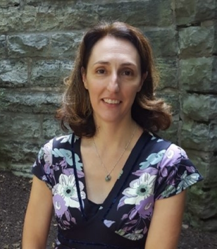
Mary F. Perrelli, M.A.
GIS Lab Supervisor Buckham Hall A125Phone: (716) 878-3699
Email: perrelmf@buffalostate.edu
Mary Perrelli assists Buffalo State faculty and local professionals with GIS and she has participated in numerous on-campus workshops and ESRI training. She maintains the departmental computer labs. She has mentored GEG/PLN 430 (Senior Thesis) students in topics such as the use of GIS in town planning. She also serves as the GIS technician on grants and grant applications which require the use of GIS/GPS technology. My teaching interests are in Geographic Information Systems and web mapping. Courses taught include: GEG/PLN 325 Maps and Map-making using GIS and GEG 485 Interactive and Web-based Mapping
Selected publications | Technical reports | Conference Proceedings
Selected publications
Tang, T., M. Radomski, M. Stefan , M. Perrelli and H. T. Fan, 2020. UAV-based high spatial and temporal resolution monitoring and mapping of surface moisture status in a vineyard. Journal of Papers in Applied Geography. Vol. 6, Issue: 6. https://www.tandfonline.com/doi/full/10.1080/23754931.2020.1798808
Tang, T., L. Jiang and M. Perrelli, 2020. Data Collection and Analyses Applying Unmanned Helicopter (UAV) Remote Sensing to Survey Water Chestnut Invasive Species.International Journal of Data Analytics, Volume 1, Issue 1 January-June 2020, Page: 38-51.
Alexander Y. Karatayev, Lyubov E. Burlakova, Thomas D. Miller and Mary F. Perrelli, Reconstructing historical range and population size of an endangered mollusc: long-term decline of Popenaias popeii in the Rio Grande, Texas, Hydrobiologia, 10.1007/s10750-015-2551-3, 810, 1, (333-349), (2015).
Forsythe, K.W., K.N. Irvine, D.M. Atkinson, M. Perelli, J.M. Aversa, S.J. Swales, A. SGawedzki, and D.J. SJakubek. 2015. Assessing Lead Contamination in Buffalo River Sediments. Journal of Environmental Informatics 26 (2): 106-111.
K. Wayne Forsythe, Adrian Gawedzki, Peter Rodriguez, Kimberly N. Irvine & Mary Perrelli (2013):Geospatial Estimation of Mercury Contamination in Buffalo River Sediments, Soil and Sediment Contamination: An International Journal, 22:5, 521-531.
M. Perrelli and K. Irvine. Planning Level Modeling of E. coli Levels in a Suburban Watershed Using PCSWMM. Pragmatic Modeling of Urban Water Systems, Monograph 21, 423-435, Toronto, Ontario, Canada 2013.
K.N. Irvine, M.F. Perrelli, R. Ngoen-klan, I. G. Droppo. 2009. Metal levels in street sediment from an industrial city: spatial trends, chemical fractionation, and management implications. Journal of Soils and Sediment, Volume 9, Issue 4 , Page 328.
Irvine, K.N., M. Perrelli, N. Brown, and M.C. Rossi. 2006. Septic system pollution prevention BMPs: development of public outreach approaches and decision-making tools for local government. Clearwaters, 36(3): 51:55.
Perrelli, M.F., Irvine, K.N. and T.S. Lee. 2005. Calibration of BASINS HSP-F in support of a watershed approach to CSO long term control planning. Effective Modeling of Urban Water Systems, Monograph 13.
Irvine, K.N., Perrelli, M.F., McCorkhill, G., and J. Caruso. 2005. Sampling and modeling approaches to assess water quality impacts of combined sewer overflows- The importance of a watershed perspective. Journal of Great Lakes Research 31: 105-115.
Perrelli, M.F. 2003. Use of texture for the retrieval of industrial complexes in a digital image database. Middle States Geographer 36: 113-121.
K.M. Frothingham and M.F. Perrelli. 2001. Assessing the representativeness of stream geomorphology parameters in BASINS. Middle States Geographer 34: 48-54.
Conference Proceedings
SUNY CIT Conference, SUNY Oneonta. June 2, 2017. Mary Perrelli. Developing GIS Course Modules for Introductory Science and Social Science Courses.
NYGEOCON, Albany, NY. October 28 2015. Developing a Tech Hub to Promote the Use of Geographic Information System Technology.
2016 Western New York Stormwater Conference and Trade Show, Buffalo, NY. April 5, 2016. “The Campus MS4: SUNY Buffalo State’s Model SWMP” 2016 Western New York Stormwater Conference and Trade Show, Buffalo, NY.
March 24, 2015. Greater Buffalo Environmental Conference. Buffalo, New York. ‘WNY Stormwater Coalition MS4 Mapping Project”. Co-presented with Lisa Matthies-Wiza, Erie County Department of Environment and Planning.
Office of Faculty Development, & Computing and Technology Services at SUNY Buffal State. April 15, 2015. “Tech Talk: Geographic Information Systems Tech Hub”.
Small Business Development Center, Buffalo State. May 20, 2015, with Wende Mix. “The Power of Information Managing data: Geographic, Demographic and much more to help you become more competitive."
24th Annual Conference of Instruction & Technology (CIT 2015), Geneseo, New York. May 27, 2015. “Developing a Tech Hub to Promote the Use of Geographic Information System Technology.”
2014 Western New York Stormwater Conference and Tradeshow, Buffalo Convention Center. March 19, 2014. “Mapping the MS4: Storm Sewer System Data Collection and Field Methodology”.
Technical reports
J. Gould, K. Reth, K.N. IRvine and M.Perrelli. Cayuga Creek, Niagara Coutny, N.Y. 516(e) Sediment Transport/Delivery Model. Prepared for U.S. Army Corp of Engineers, Buffalo District. January 30, 2009.
M.F. Perrelli and K.N. Irvine. Receiving Water Modeling- Buffalo River Interim Report on Hydrologic Calibration and Validation. Prepared for URS Greiner Woodward Clyde, Buffalo, NY. June 29, 2001.

